Showing posts with label ARkansas Delta. Show all posts

Sunday, July 5, 2015

Counting Bee Hives

A person managing a number of bee hives often finds the total number of hives holding live bees varies throughout the year. Typically, beekeepers combine colonies into fewer hives in the fall in preparation for winter. Then, in the spring, they make colony divisions from strong surviving colonies to occupy a greater number of hives. Throughout the year, hive numbers may increase or decrease as the beekeeper purchases colonies, captures swarms, or colonies die. There are occasions during the year when it is very useful for the beekeeper to record the number of active hives in the various bee yards. Counting the number of hives in the fall that are prepared for winter and later, in the spring, counting the number of hives surviving the winter gives the beekeeper a measure of over-winter losses. An important measure of honey yield involves counting the number of full-size hives in place during the major nectar flows. To calculate the honey yield per hive, the beekeeper simply divides the number of pounds of harvested honey by the number of full-size hives at nectar-flow time. In the Arkansas Delta, Independence Day, July 4, is a good time to count hives, as this date falls within a major nectar flow of the region’s two major nectar sources, soybeans and cotton.

By measuring the honey yield per hive of different bee yards, the beekeeper can determine which areas are the better producing ones. Yields will often vary widely from year to year as crop plantings are rotated. Bee yards in proximity to soybeans and cotton may produce an abundance of honey in one year; however, if the near-by fields are planted the next year with corn, wheat, rice, or sorghum—crops that produce no nectar—honey yields may be greatly reduced. Bee yards with a history of poor honey production may need to be abandoned for more productive sites. In today’s photo, Arkansas Delta farmers prepare a grain combine equipped with a Honey Bee model header.
--Richard

Sunday, November 3, 2013

Delta Crossings

Cold, dry air from the north crosses warm, damp air from the south over the United States’ mid section, an area known as “Tornado Alley.” This is the only area in the world that regularly sees tornados. These storms occur in greatest frequency as seasons change in the spring and fall. A tornado struck the Arkansas Delta town of Caraway tearing down trees, utility poles, and power lines. A number of homes were heavily damaged. A beekeeper friend’s home sat in the storm’s path; it sustained minor damage. The beekeeper and his wife ducked safely into their storm shelter as the storm struck.  Large trees fell around them. The beekeeper checked on family, friends, and bee hives; all survived the storm. Beekeepers often divide their bee hives among several bee yards to lessen the losses from catastrophic events like fires, floods, or wind storms.

Caraway sits between the Mississippi River and the St. Francis Sunken Lands, a depression formed during one of North America’s most powerful series of earthquakes. In the winter of 1811 through 1812, earthquakes shook the area, transforming the surface of the land. The soil liquefied, and sand blew high into the air. The Mississippi River flowed backwards to fill large depressed areas which became lakes. Today, flooding in the St. Francis Sunken Lands area is controlled by a series of earthen levees, natural rivers, and man-made canals. South of Caraway where opposing winds crossed, two rivers cross in an amazing engineering feat. At Rivervale, Arkansas one river, a channelized canal, flows in a concrete tube under the St. Francis River. The rivers’ crossing can be seen in today’s photo. The concrete tube is visible horizontally under the surface of the St. Francis’ waters. Nearby, the Marked Tree Lock and Siphons are unique water control designs; the Siphons are the only structures in the United States where tubes are used to lift a river over a levee. The St. Francis River is lifted out of the Sunken Lands.
--Richard

Wednesday, September 21, 2011

Where is Tod?

A number of Peace Bee Farm’s friends and customers have been asking Rita and me, “Where is Tod?” Our son, Tod Underhill, who regularly mans our booth selling honey and bee hive products at farmers markets, is actively working on a PhD degree in Heritage Studies at Arkansas State University. His degree program involves researching and developing historic sites across the Arkansas Delta. The wide-open agricultural region encompassing 15 counties along the Mississippi River is the flattest area on the planet. Carved from bottom land hardwood forests to create cotton plantations in the 1800s, Arkansas’s Delta was the last agricultural region formed adjacent the Mississippi River. The rich alluvial land is now cultivated in row crops including cotton, soybeans, rice, wheat, corn, and grain sorghum. Today, Delta towns are largely in decline with decreased populations due to the reduced labor needs of mechanized industrial farming.

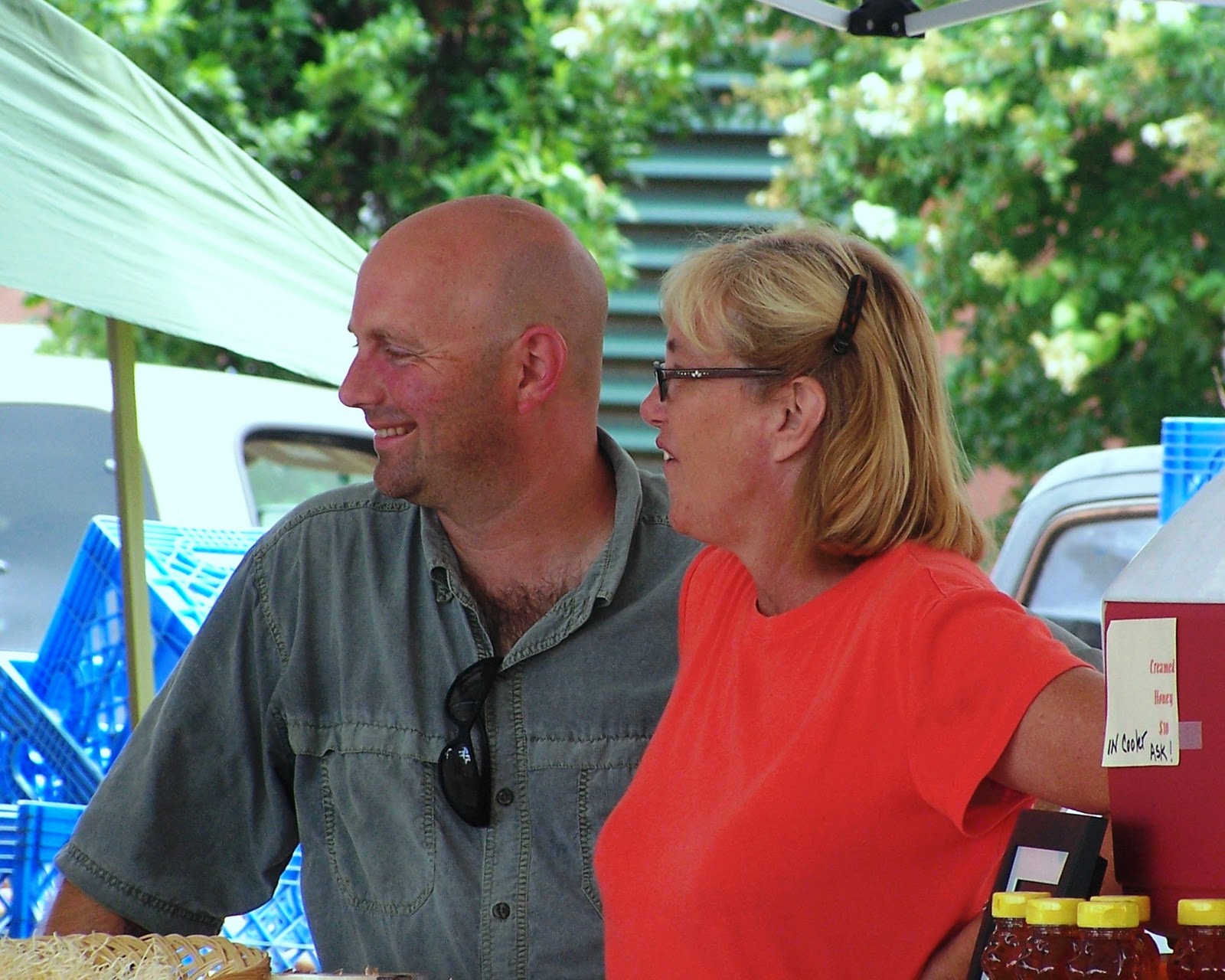
Tod may be found on ASU’s main campus at Jonesboro, Arkansas or working at ASU’s museum located in the former Southern Tenant Farmers Union building at Tyronza, Arkansas. The union was established in 1934 by black and white farmers and Tyronza businessmen. The men and women of the union demanded fair compensation for farm labor through strikes, marches, and rallies. Their non-violent protests led the way toward labor and civil rights efforts in later decades. This museum is only one of several projects the ASU program is developing to uncover and save the region’s cultural heritage. Other Arkansas Delta heritage sites include Ernest Hemingway’s writing studio, the Hemingway-Pfeiffer Home at Piggott; the historic Dyess Colony and Johnny Cash’s childhood home at Dyess; and the 1859 Lakeport Plantation at Lake Village, the only remaining antebellum plantation home in the Delta. Arkansas Delta Byways includes tourism routes through the Delta which are extended through the Great River Road linking 10 states along both sides of the Mississippi River from Canada to the Gulf of Mexico. Today’s photo: Tod and Rita at a farmers market.
--Richard

Friday, July 1, 2011

Arkansas DeltaMade

The Arkansas Delta is an economically depressed agricultural region with a rich heritage located on the most fertile soil in the world. The land produces food and fiber on large farms, models of industrial agriculture. These modern row-crop farms produce soybeans, cotton, rice, corn, wheat, and grain sorghum using a minimum of tillage. Mechanical cultivation of the soil to control grasses and weeds has largely been eliminated by the use of genetically modified crops and herbicides. With agricultural labor needs greatly reduced, employment opportunities in the Delta became scarce. Many of the cities in the region lost population; some resembled ghost towns. Three years ago, a non-profit organization called Arkansas DeltaMade, http://www.arkansasdeltamade.com/,   formed to help market goods produced in the 15 Delta counties along the Mississippi River. DeltaMade located artists, craftsmen, potters, woodworkers, cooks, and individuals with numerous skills. Peace Bee Farm was proud to be one of the first businesses selected to carry the DeltaMade logo.

The story of DeltaMade was carried on ABC World News. See the story and the short video “Made in America: Marketing the People Behind the Product” at http://abcnews.go.com/Business/made-america-marketing-people-product/story?id=13969196#.Tg0kHZZxEfQ.facebook. Producer Erin Hayes questioned Rita and me along with DeltaMade’s Beth Wiedower about the effectiveness of promoting cottage industries as a means of reviving economic development in the Delta. DeltaMade has created or saved three hundred jobs in the area since its creation. We also pointed to the work in Appalachia by the Coal Country Beeworks, http://www.eri.eku.edu/honey.php, for creating jobs in the mountains of Eastern Kentucky and West Virginia. Perhaps, the time is right to use home and community-based businesses to support local economies. Many of these would not exist without the assistance and promotion of groups like DeltaMade. In today’s picture, captured from ABC World News, Rita and I discuss marketing of locally produced products at Helena, Arkansas. We find that the producers take great pride in the region. We appreciate the attention given to those who work to revitalize the Arkansas Delta.
--Richard

Saturday, January 1, 2011

Winter in the Delta

The Arkansas Delta is the winter home of many migratory birds. Located along the central flyway, great numbers of waterfowl from Canada and the northern United States winter in the Delta. The harvested agricultural fields offer the migratory visitors ample high-energy food, and the Mississippi River and its tributaries afford cover and protection. The temperate Arkansas Delta experiences four distinct seasons. As fall turns into winter, ducks and geese arrive in great numbers. The last week of December brought large flocks of pintail ducks, as seen in today’s photo. I encountered these puddle ducks feeding in the wet stubble of a harvested rice field near one of our bee yards. Other fields hold mallards and northern shovelers, both colorful puddle ducks. Wary wood ducks hide in tree-lined corners of lakes on our bird sanctuary. Overhead, large flocks of snow geese can be seen throughout the day. A few dozen Canada geese drop in with our domestic geese at sundown. The birds gain weight in the winter eating high-energy spilled grain, plant material, and invertebrates. The migrants are driven to the South by snow cover preventing them from accessing food. They will remain in the Arkansas Delta throughout the winter unless the surface remains hard-frozen for an extended period. Then, they will move further south. The area’s farmers welcome the migratory waterfowl; many flood fields to provide food for the birds. The birds help control crop weeds, especially red rice, by eating the seed in flooded fields.

The waterfowl evolved a survival strategy based upon migrating with the changing seasons. In the fall and winter, they leave their snow-covered northern range and fly hundreds of miles to suitable grounds in the South. Some, like gadwalls and American wigeons fly early, but most wait until late. Migrating at night, they let the strong North winds of an arctic cold front carry them South, saving a great amount of energy. Meanwhile, honey bees remain inside their hives, generating warmth from high-energy honey.
--Richard

Friday, February 5, 2010

Winter in the Delta

With the honey bees tightly clustered in dry hives, consuming enough honey to maintain warmth, I often venture out the Delta back-roads to get in some winter bird watching. The Arkansas Grand Prairie and Delta region is the winter home for much of North America’s waterfowl. Large numbers of ducks, mainly mallards, from the central provinces of Canada winter in the wet agricultural fields. Here, the waterfowl find an ample supply of grain spilled by mechanical harvesting. The birds also derive considerable amounts of protein from mollusks and earthworms. Snow geese converge by the thousands on fields of winter wheat, where they pull the tender, green plants, roots and all, from the soil. Covering the ground, the white snow geese and their color phase of the same species, the blue goose, appear as dirty snow. All wildlife has four habitat requirements: food, water, space, and cover. The Delta provides plenty of food and water, and the space is wide open for miles on end. While most wildlife needs escape cover in which the creatures may flee into protective woods, the waterfowl employ their sense of sight, gregarious behavior, and use of sentry birds to protect themselves from predators.

Click on today’s picture to see a trumpeter swan, a rare find in this area. The trumpeter is the largest waterfowl in North America and the largest swan in the world. I observed this single swan feeding on aquatic plants in a flooded rice field along with Northern Shoveler ducks. This arctic visitor was the first trumpeter I’ve found in the wild. Farmers often close drain pipes in levees surrounding level fields to allow the area to flood in the winter. While the flooded fields provide winter habitat for the waterfowl, the birds serve the farmers by sifting weed seeds from the mud. Good winter-time nutrition leads to greater reproductive success for the waterfowl. Nutrition is, likewise, being seen as being of great importance in managing healthy honey bees.
--Richard

Wednesday, July 22, 2009

Arkansas Rice

Honey bees in the Arkansas Delta are surrounded by open agricultural fields in a variety of crops. One of the most beautiful sights is a flooded rice field. The lush plants grow in several inches of water held in place by levees which trace the contour of the land. Some of these crops, notably cotton and soybeans, produce an abundance of nectar for the honey bees to use to make honey. Other crops produce no nectar and are virtually worthless to the honey bees. The crops that produce nectar are flowering plants; the crops that don’t produce nectar are grasses. Rice is a grass, as are corn, wheat, and grain sorghum, which is often called milo. The rice fields do, however, provide a convenient source of water for the honey bee colonies. The bees find favorable watering places along the rice field levees. The bees like to collect water in sunlit spaces in the open. The Delta is wide-open flat land. A line of trees marks a drainage canal. In the summertime, water may be scarce; and a close-by rice field may quite welcome. Bees collect a considerable amount of water to cool the hive.

Arkansas produces about 45 percent of the United States’ rice crop with about 1.3 million acres planted in eastern Arkansas. Other states producing rice are Texas, California, Louisiana, Mississippi, and Missouri. Rice is shipped from Arkansas around the world.
--Richard